
Service Surveying & Mapping

Access expert surveyors
Our experienced, long-term field survey crews are fully trained on the Calvin, Giordano & Associates, Inc. (CGA) surveying standards and are familiar with the laws affecting surveying. This familiarity of the practices and policies of their experience allows CGA to maintain our budget and schedule throughout a project.
We are continually providing our employees with both on-site and off-site training, web seminars, and other educational tools to improve their capabilities — and in turn, improve our capabilities.
SPEAK TO AN EXPERTEmploying state-of-the-art surveying equipment
As the surveying profession has advanced in both technology and education, CGA has invested significant resources to keep abreast of these advances.
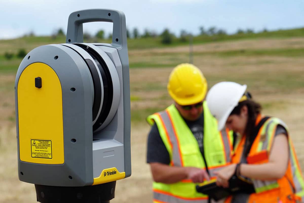
Trimble X7
Our Trimble X7 takes a virtual snapshot of a site with a level of detail that previously would have taken significantly more field and office resources.
By collecting millions of data points in a 360° horizontal and 270° vertical field of view, field crews can survey a site once and have a permanent record of all the visible items on file.
Surveying & Mapping Services
- Boundary Surveys
- Topographic Surveys
- Record (As-Built) Surveys
- Utility & Infrastructure Layout
- Global Positioning System Surveys
- Route Surveys for Engineering Design
- Condominium Document Preparation
- Platting Services
- Right of Way Mapping
- Annexation Maps
- Sketch and Legal Descriptions

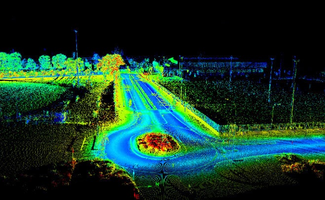
Timely, accurate GIS data collection
With a full-scale GIS Department providing data population and application development for multiple government entities, our Survey Department provides efficient field data collection for rapid download into GIS databases. We can provide detailed and accurate surveying data for engineering projects relating to water distribution systems, storm drainage, and sanitary sewer infrastructure.
Using Trimble Real Time Kinematic (RTK) GPS equipment with Bluetooth wireless technology and tying into the Florida Continuously Operating Reference Stations (CORS) allows us to collect vast amounts of data referenced to the latest horizontal and vertical datums as established by the National Geodetic Survey (NGS) Department.
See our services in action
Planning and Zoning Hillsboro Beach, FL

Miami Dade TPO
Weston, FL Comprehensive Plan
CDBG Grant Administration

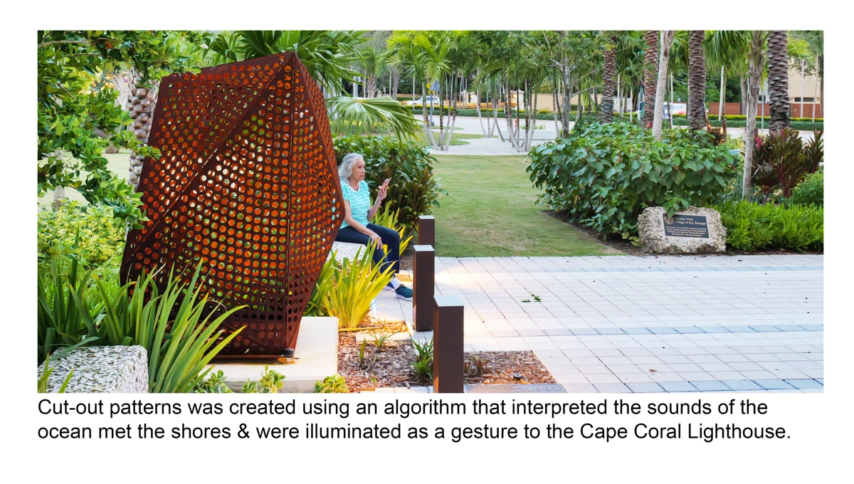
Paradise Park
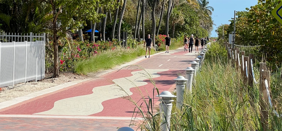
Miami Beach Recreational Corridor (MBRC)
Antelope Creek Park

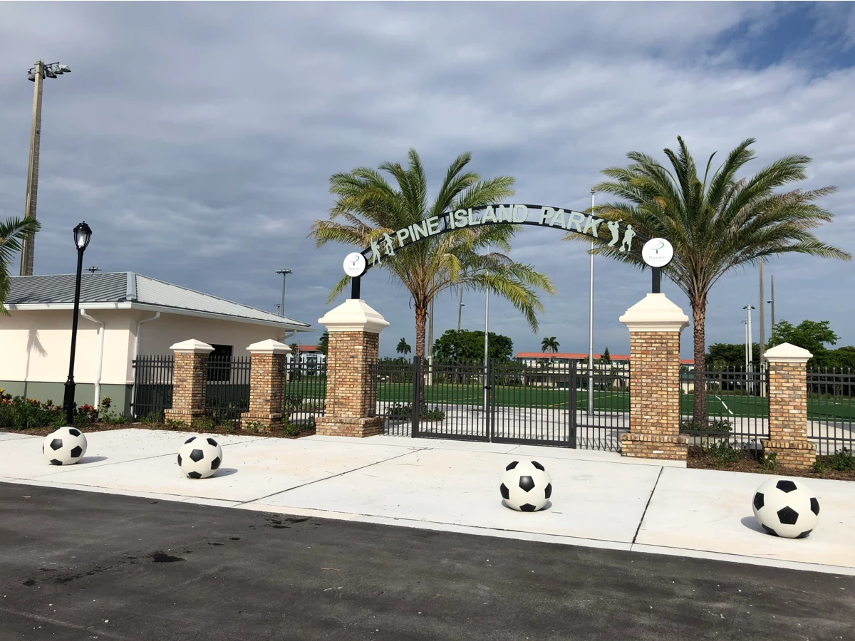
Pine Island Park Improvements
Broward County Highway Construction and Engineering Division

Cattlemen’s Square Landscape Architecture and Urbanism